West Waigeo Islands & Surrounding Areas Marine Reserve
271,630 hectares
The West Waigeo & Surrounding Islands Marine Reserve covers the territorial waters of the Sayang and Piai Islands, within the Wayag islands group. This conservation area is located northwest of Raja Ampat, bordering the Halmahera Sea, and covers an area of 271,630 hectares.
As a National Marine Reserve (Suaka Alam Perairan – SAP) the area is managed by the “Balai Kawasan Konservasi Perairan Nasional (BKKPN)” – a technical implementation unit under the Ministry of Maritime Affairs and Fisheries. In practice, the Marine Reserve is managed collaboratively with the Raja Ampat Marine Park Authority, local governments, law enforcement agencies, and non-governmental organizations.

West Waigeo SAP is home to Wayag, an iconic tourist destination known for its beautiful karst island scenery. The islands in the Western SAP Waigeo region are uninhabited, and their ownership is regulated under the customary law of the local people which states that Wayag belongs to the Kawe sub-tribe who inhabit the islands of Saleo and Selpele.
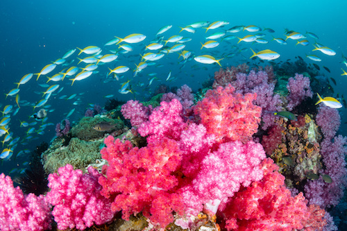
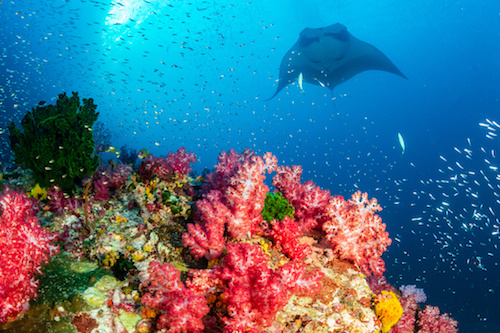
The West Waigeo MPA is a habitat for an abundance of marine life including sharks, mackerel, grouper and vibrant coral reefs. The area is part of an important migration route for whales and dolphins, and the Wayag Islands contain a number of manta ray cleaning stations, and provide habitat for sea cucumbers, lobsters and top shell, all of which have important economic value.
Sayang and Piai Islands are nesting sites for a several vulnerable and critically endangerd sea turtles species. These nesting beaches lie within Core Zones, where entry is granted only through a restricted permit that covers very limited purposes.
Prior to their establishment as conservation areas, Wayag, Sayang and Piai islands were a source of livelihood, both sustainable and unsustainable, legal and illegal, for the people of Raja Ampat and Halmahera. These communities had used this land to grow coconut palm plantations and fished the surrounding waters for sea cucumbers, lobsters, groupers, sharks turtles and coconut crabs. The area was also known for shark finning. The thriving ecosystems in this MPA were threatened by large scale fishing from outside fishermen, the use of destructive fishing practices, shark finning, turtle hunting (meat and eggs), as well as contamination from mine waste runoff and spills. However, these destructive activities slowly diminished as efforts to establish a Marine Reserve began to intensify in 2007.
The area was designated as an Marine Reserve through a Raja Ampat Regent Decree (Perbup) No. 66 of 2007, and was later reinforced by a Regional Regulation (Perda) Raja Ampat No. 27 in 2008. In 2009, the central government nominated this area to become a national MPA, and so was endorsed under the Minister of Marine and Fisheries decree No. 65 Year 2009.
Zoning – West Waigeo National MPA
Click on Map to expand, and see Legend below.

The table below provides a general description of the main activities that occur within Marine Protected Areas. For a detailed description of all activities affected by Zoning Regulation, please refer to Table 14, pages 48-51 of the Raja Ampat Marine Park Management and Zonation Plan 2019-2038
Click table to enlarge

Copyright © Conservation International 2019 – 2020.