Mayalibit Bay MPA
49,451 hectares
Mayalibit Bay Marine Protected Area (MPA) has an area of 49,451 hectares and almost splits the island of Waigeo into two parts. Mayalibit Bay has vast mangrove and seagrass habitats, with seagrass spreading across 70m from the edge of the mangrove forest to the coast. Although the percentage of hard corals is relatively small, Mayalibit Bay has great potential as a growth area for fish and other species with high economic value, including mackerel (Scombridae), samandar (Siganidae), shrimp, trevally (Carangidae), snapper (Lutjanidae) and mud crab (Scylla). The main commodities in Mayalibit Bay are mackerel (Rastrelliger sp.) and dried shrimp. Nearly all mackerel fish consumed in Raja Ampat comes from Mayalibit Bay, and the results of the study confirm that the waters around the bay mouth are important spawning grounds for this species.
To strengthen the management of fisheries resources in Mayalibit Bay, local communities, in collaboration with Raja Ampat Marine Park Authority, and non-profit organizations such as Conservation International (CI) and RARE developed the Indigenous Fisheries Area (KPA) initiative . This initiative agrees on the rights to use fisheries resources in Mayalibit Bay based upon the customary territories of each village or hamlet. In practice, the management and supervision of this MPA is the responsibility of each village and sub-village, assisted by the Marine Park Authority.
Mayalibit Bay is believed to be the origin of the Maya, the indigenous people of Raja Ampat, who still inhabit the villages of Yensner, Mumes, Warsambin, Lopintol, Kalitoko, Warimak, Waifoi, Go, Kabilol, Beo, Arway and the Hamlet of Wegalas. Administratively, the Mayalibit Bay is divided into two; the Mayalibit Bay District which is inhabited by 776 people and the Mayalibit Tiplol which is inhabited by 852 people (Raja Ampat Regency Statistics Agency, 2017).
Mayalibit Bay was the first official Marine Protected Area in Raja Ampat. On November 15, 2006, the Mayalibit Bay community performed a custom declaration in the village Waifoi, handing over the local mandate to manage the region’s fish stocks to ensure sustainability, to the Raja Ampat government. The custom declaration was then followed by a declaration at the district level by the Regent of Raja Ampat, Drs. Marcus Wanma (M.Sc), endorsing the MPA with an area of 53,100 ha, along with five other MPAs, including Misool Islands, Kofiau-Boo Islands, Dampier Strait, Wayag (now named Waigeo Waters Nature Reserve West), and the Asian and Ayau Islands.
The declaration at the district level was immediately followed with a decree from the Head of District in 2007, which was then strengthened through regional regulations in 2008, before finally obtaining the legal status of MPA in Raja Ampat by decree of the Minister of Maritime Affairs and Fisheries in 2014. This degree is currently being revised to include new MPAs in Fam Islands and North Misool.
Zoning – Mayalibit Bay MPA
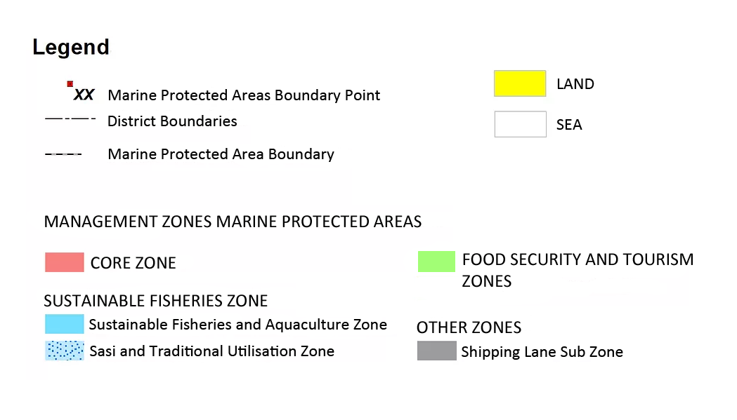
Click Map to expand, and refer to Legend below

The table below provides a general description of the main activities that occur within Marine Protected Areas. For a detailed description of all activities affected by Zoning Regulation, please refer to Table 14, pages 48-51 of the Raja Ampat Marine Park Management and Zonation Plan 2019-2038
Click table to englarge.
Copyright © BLUD UPTD Pengelolaan KKP Kep. Raja Ampat 2020.


