Raja Ampat Islands & Surrounding Seas Marine Reserve
60,000 hectares
The Raja Ampat Islands and Surround Seas Marine Reserve is located southwest of Waigeo Island and bordered by Waigeo Island to the North, the Fam Islands in the South, Gam Island to the East and Batangpele Island and Manyaifun Island to the west.
The Marine Reserve is a conservation area whose management and authority is under the Ministry of Maritime Affairs and Fisheries through “Balai Kawasan Konservasi Perairan Nasional (BKKPN)”, which collaborates with other stakeholders in Raja Ampat; including the Raja Ampat Marine Park Authority
There are five villages within the Marine Protected Area, including Manyaifun, Bianci, Mutus, Meosmanggara and Waisilip, which is the capital of the West Waigeo District . Although Manyaifun sits just outside the border of the MPA, it is ‘unofficially’ considered part of the Marine Reserve, in consideration of the local community fishing practices that occur in the area.
The local people living in this area are descendants of the Biak Betew/Beser Raja Ampat, Kawe, Tidore, Buton and Beser Raja Am pat tribes, with several clans within each tribe, all of whom interact harmoniously and dynamically within communities.
In general, the livelihoods of residents in the villages in the Marine Reserve are still very traditional, with fishing for family consumption being a primary livelihood, supported by gardening or collecting food from the forests.
As one of the more remote locations within Raja Ampat, this region is less developed than other more popular and accessible areas, and as such, reflects a more ‘traditional’ Raja Ampat. Coral reef ecosystems are healthy, with anecdotal evidence from local community members suggesting that manta rays are frequently sighted throughout the waters of the Marine Reserve.
Given the region’s relatively remote location, coupled with its marine ecological condition, the territorial waters of this Marine Reserve has become a target for illegal and/or destructive fishing activities, carried out by fishermen from both inside and outside of the area. It is only through collaborative management and enhanced supervision efforts that the intensity of illegal and destructive fishing practices can be reduced, or even eliminated.
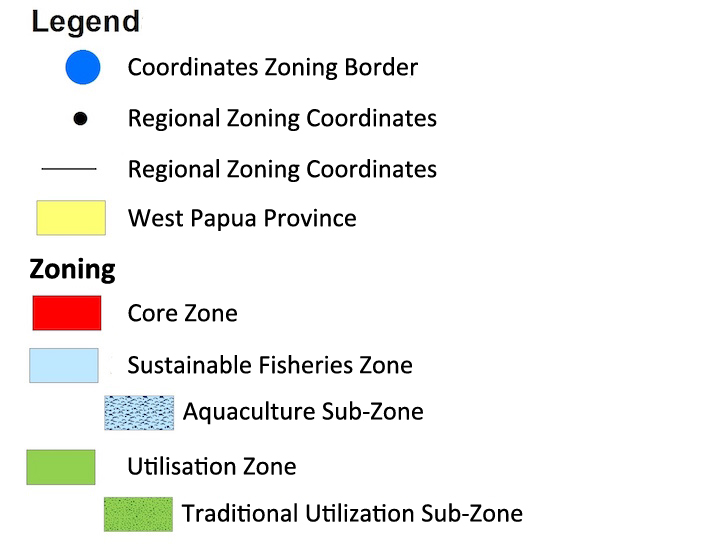
Zoning – Raja Ampat National MPA
Click map to expand, and refer to Legend below.
Copyright © Conservation International 2019 – 2020.


